-
Your Government
-
- Mayor & City Council Street Improvement Funding Ad Hoc Committee City Charter and Code Agendas and Minutes City Meetings Calendar Job Opportunities Volunteer Opportunities
- Boards or Commissions Audit Committee Budget Committee Historic Preservation Commission Planning Commission Urban Forestry Committee VisionKeepers Youth Advisory Council Federal, State and County Government Links City Information Kiosk
- City Budgets Annual Audits Election Information Public Records Friday Update Vision 2037 Homelessness
-
-
City Departments
-
- City Manager Friday Update Elections Public Records Information Kiosk Finance Audits Budgets Utilities Utility Service Forms Pay Bill Online
- Public Works & Dev. Public Works Construction Corner Hydrant Flushing Program Pothole Spotter Leaf Pickup Program Annual Tree Branch Pickup Water Quality Reports System Development Charges Community Development Pedestrian and Bicycle Plan Planning and Landuse Building Department Emergency Management Main Street Refinement Project
- Cottage Grove Armory Community Center Library Middlefield Golf Course Municipal Court Peer Court Police
-
-
Doing Business
-
- City Charter and Code Building and Development Development Code Building Department Landuse & Zoning Applications System Development Charges
- Lane Business Link Chamber of Commerce Business Licenses Cottage Grove Community Development Corporation Industrial Park
- Bids and RFPs Projects Forms and Permits Utilities Information Recycling Information
-
-
For Visitors
-
- Chamber of Commerce Community Links Travel & Recreation Swimming Pool Travel Lane County Cottage Grove Lake Dorena Lake Cycling Opportunities Row River Trail Umpqua National Forest - Cottage Grove Ranger District Oregon Department of Transportation Trip Check
- Events and Activities City Meetings Calendar Community-Wide Calendar Covered Bridges Chambers Covered Railroad Bridge Covered Bridges Scenic Bikeway Library Middlefield Golf Course Cottage Grove Disc Golf Course
- Cottage Grove Armory Schools Area School Links Cottage Grove Hospital Public Safety Police Fire City Information Kiosk
-
-
Community Resources
-
- Job Opportunities Volunteer Opportunities Utilities Information Alerts and Notifications Email Subscriptions Events and Meetings Agendas and Minutes City Meetings Calendar City Wide Events Calendar Services Directory
- Contact the City Submit a Request or Concern City Offices Staff Directory Documents and Forms Documents and Reports Forms and Applications Pothole Spotter Emergency Preparedness Emergency Management Flood Information
- Social Media Facebook Twitter YouTube In the News Friday Update City News Yard of the Week Yard Sales
-
Historic Floods
Flooding profile
The City of Cottage Grove is located south of the confluence of the Row River and the Coast Fork of the Willamette River. These two rivers as well as Silk, Mosby, and Bennett Creeks contribute to the flooding hazard in Cottage Grove. The city itself is located wholly within the Coast Fork Willamette Watershed Basin.
The Coast Fork of the Willamette River runs north then northeast through the center of the city along a fairly narrow, channelized corridor that has seen development since the founding of the community in the 1860’s. The original channel has been heavily modified. Some slight movement of the Coast Fork Willamette channel has been seen in its more northern reaches within City limits.
The Row River forms the City’s eastern boundary. Its channel remains fairly natural, with multiple meanders and a wide, vegetated floodplain. Much of the Row River floodplain in the City is under City of Cottage Grove ownership as a measure of floodwater control. The Row River joins the Coast Fork of the Willamette River immediately to the north of the city’s urban growth boundary. Silk Creek enters the city from the west from the foothills of the Coast Range. This creek flows through the back yards of several residential neighborhoods before crossing under River Road via a culvert to join the Coast Fork. Mosby Creek joins the Row River east of the City, west of Dorena Lake.
The U.S. Army Corps of Engineers operates 13 multi-purpose flood control projects (dams) in the Willamette Valley Project, nine of which are located in Lane County, and were constructed between 1941 and 1968.
The Dorena Dam was built on the Row River upstream of Cottage Grove in 1942. This federally owned dam is operated and maintained by the U.S. Army Corps of Engineers, as a part of the Willamette Valley Project. The structure is 154 high, and has 131,000 acre feet of storage in this earthen type dam.
The Cottage Grove Dam was built on the Coast Fork Willamette River upstream of Cottage Grove in 1943. Like Dorena, the dam is owned federally, operated and maintained by the U.S. Army Corps of Engineers as a part of the Willamette Valley Project. The structure is 103 feet high, and has 50,000 acre feet of storage in an earthen type dam.
A primary purpose of the Willamette Valley Project is flood control, although the reservoirs only control flooding on 50% of the tributaries in the Willamette Basin. Reservoirs are maintained at full pool from May to September for recreation, and drained in the fall for the wet season to provide storage capacity for winter storms. Most riverine flooding in Cottage Grove occurs along tributaries and rivers with no flood control devices, such as Silk Creek and Mosby Creek.
Flooding occurs when climate, geology, and hydrology combine to create conditions where river and stream waters flow outside of their usual course and “overspill” beyond their banks. In Lane County, the combination of these factors, augmented by ongoing development, create chronic seasonal flooding conditions. Lane County spans a wide range of climatic and geologic regions from the Pacific coast to the high Cascades. This diversity results in considerable variation in precipitation. The average annual precipitation ranges from less than 40 inches in the Willamette Valley to over 100 inches in the Coast Range and along the west slope of the Cascades. Snowmelt from the Central Cascades provides a continuouswater source throughout the year, and can contribute significantly to flooding.
Flooding is most common from October through April, when storms from the Pacific Ocean bring intense rainfall to the area. Larger floods result from heavy rains that continue over the course of several days, augmented by snowmelt at timewhen the soil is near saturation from previous rains.
Previous Occurences
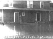
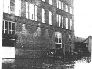
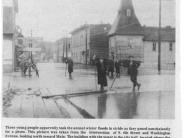
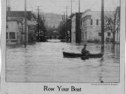
Cottage Grove has a long history of flood events. The most heavily flooded areas are the low lands along the Row and Willamette Rivers, and the properties adjacent to Silk Creek. The following historical recount of flooding was developed from the Cottage Grove Development Timeline created by community members using data from local historical resources, such as the Cottage Grove Museum.
- 1861 Floods hit the area
- 1881 Floods in the town
- 1926 People rode rowboats into the Bartell Hote
- 1933 Flood in the town
- 1946 January heavy rains…4.32 inches-Floods
- 1961 February Floods-4.74 inches in 24 hours
- 1963 High water at Christmas
- 1964 High water again
- 1985 Flooding in the area with heavy rains
- 1996 100 inches of rain, flooding along Silk Creek, Mosby Creek
Since the construction of Cottage Grove and Dorena Dams in the 1940s, flooding has been less severe along the Row River and Coast Fork of the Willamette. These dams have reduced the expected 100-year stream discharges (volume of water flowing in the rivers). Hence expected flood elevations and overall flood potential for major flood events along these rivers have been substantially reduced. The flood hazard areas shown on the current Flood Insurance Rate Maps (FIRM) for Cottage Grove assume that the dams are operating properly. Dam failure hazards are not addressed by the FIRM.
Despite the reduction in flood potential from construction of the dams, the Cottage Grove area continues to face flood risks from the Coast Fork Willamette and Row Rivers as well as smaller creeks like Silk Creek and Bennett Creek. Flood risk on these smaller streams has not been reduced by the dams.
The most recent major flood event occurred in February 1997. Unusually heavy rains over the four-day period from February 5th to February 8th resulted in significant flooding on numerous rivers and streams throughout western Oregon. The 1997 flood may have been about a 250-year event. During this flood event, Silk Creek flooded adjacent properties, and the Row River raised high enough to damage the city’s current water treatment intake facility. Damage to Lane Countybusinesses, residences and infrastructure was estimated to be roughly $19 million dollars for this February 1997 storm.
In January 2011, several days of heavy rain caused isolated flooding throughout the County, although little or no flooding occurred within Cottage Grove. Saturated soils caused the loss of the Coast Fork Willamette River bank in a few locations, and overloaded storm drains caused isolated street flooding in the community. These locations were documented by city maintenance staff for future maintenance. At the end of the event, the U.S. Army Corps of Engineers opened the floodgates on the Cottage Grove and Dorena Dams, rapidly raising the levels of the Coast Fork and Row Rivers. The prolonged high waters weakened many riparian trees along the Coast Fork. Although Lane County activated its EOC during this event, Cottage Grove had no need to do so.
It should be noted that stormwater is not treated in the City wastewater system. There exist remnants within the city of older piping that combines stormwater into the sewer system, increasing unnecessary costs in waste water treatment. These remnants are addressed and removed on a case by case basis when found and as funding is available.
The City of Cottage Grove takes a three pronged approach to addressing flood hazards in the city:
-
Administration of regulations applying to private property.
-
Maintenance / enhancement of City-owned facilities and utilities.
-
Education and awareness of flood risks.
In addition to this three pronged approach, the city is mindful of meeting all minimum federal requirements with regard to federal flood legislation, laws, regulations, and local code. These include compliance with Presidential Executive Order 11988 (1977) “Floodplain Management” as amended in 2015, and incorporation of changes into current city code. The City also prepares needed documentation for the National Flood Insurance Program (NIFP).
The City has established a Floodplain Manager in the person of the Community Development Director. The City is actively participating in the Community Assistance Visit (CAV) program, which is a major component of the NFIP's Community Assistance Program (CAP). The most recent CAV occurred on February 11, 2016 with positive reviews, and no administrative or potential violations identified. The City intends to proactively continue its efforts to reduce flood risk.
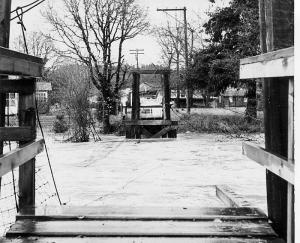
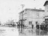
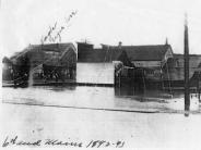
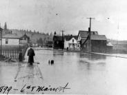
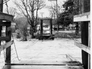
Photographs of some historic floods provided by the Cottage Grove Historical Society can be found below.
Click any thumbnail image to view a slideshow

